The 6000-Mile Mark

6000a

Rain ruled the road every minute of the two days that I was driving south through Montana, so no photos from The Treasure State to share. Happy to see the sun again in Wyoming, pictured above. Stay tuned for more Wyoming and Colorado scenery in the days ahead.

Oh, Canada

con1

A final look at Saskatchewan before I cross the 49th parallel to explore the scenery to the south.

I love these giant beasts. I saw many of them throughout Alberta, Saskatchewan and Montana…

con2

shaun

Prairie scenery on a smaller scale…

flar2

flar1

flar3

Golden…

bales

Thank you, Canada!

No Ghosts Here

rob1

This post comes to you through the efforts of an online friend, Cam McLean, who recently shared some of his photos taken in the ghost town of Robsart, Saskatchewan, and inspired me to visit this interesting place on my recent journey through the area. Be sure to check out Cam’s portfolio here. Thank you, Cam!

***

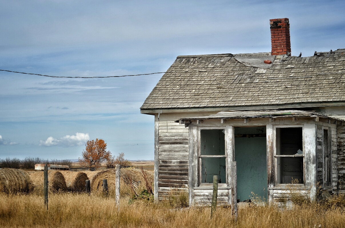
As I rolled slowly into Robsart from the north, I spied two men having a conversation in front of the community hall. I parked on the edge of the street and walked forward. They greeted me warmly and one of the gentlemen guessed correctly why I was there: “You read online that this was a ghost town, right?” That man, Lorne, smiled and told me that he had lived in Robsart his entire life and had never seen a single ghost.

I spoke with Lorne for quite some time; he was very friendly and happy to talk about life in this tiny prairie village. One might consider Lorne to be the “mayor” of Robsart, as he now owns most of the abandoned properties. He informed me that five of the homes are still occupied. While we talked, I could see children playing in a back yard down the block.

Lorne’s story of Robsart is one familiar to people in small towns and rural areas all across North America: Young people wanting to move to the cities for more opportunities and excitement, and small, family farms being swallowed up by gigantic commercial farming operations. There are no services in Robsart, and folks have to drive across the plains to one of the neighboring towns for food, fuel and other needs.

Lorne, tired of fighting the caprices of the weather, has decided to get out of the crop game and let his fields go to grass so he can raise cattle. But he has no plans to leave Robsart.

Every ghost town has a story; I’m glad that I had the chance to hear this one from a proud resident.

rob2

rob3

rob4

rob5

rob6

rob7

rob8

Cypress Hills

ch1

More scenes from last Tuesday’s drive to the top of Saskatchewan.

My final seconds in Alberta; the fence on the left marks the Saskatchewan line…

ch2

At the summit: The highest car in SK…

ch3

Heading back down…

ch4

A hill. And there’s no fence around it! I’ve written before of my strong desire to climb every hill that I see; when I find one that isn’t fenced in, you bet I’m going to the top, even if it isn’t a particularly high hill…

ch5

The view from the top. Spot the Pontiac yet?

ch6

Back on the prairie…

ch7

The Irrigation Ditch

irrig1

Walking down a country road in southeastern Alberta one evening (heading back to the farmhouse after shooting the images posted yesterday), I looked to my left and was struck by the beauty surrounding—of all things—an irrigation ditch. The first thing I noticed was the well-aged piece of wood angling into the water to join its reflected twin. Then I saw the reflection of the barbed wire, and the many shades of blue present on the water’s surface. The cold water was so clear that, even in the fading daylight, it was easy to see the plants growing on the bottom. And those final minutes of the sun’s rays did a wonderful job of bringing out the colors in the grasses and the clouds.

This image is presented “as is” from the phone’s camera, without any color or exposure adjustments (it was only reduced in size for web use).

Self-Portrait atop Saskatchewan


Elevation: 1,392 m (4,567 ft) above sea level. Officially, this “peak” has no name; it is simply a broad, flat expanse of grass in the Cypress Hills of Alberta and Saskatchewan. There is little variation in elevation across the patch of land in this field of view, and the exact location of Saskatchewan’s highest point remains unmarked. Consensus places it within a few meters of my X at 49°33′N 109°59’W, just a stone’s throw from the Alberta/Saskatchewan border. This is my first state/provincial summit since last year’s ascent of Texas.

Very few people visit this spot; the “roads” are quite narrow and rocky, and they pass though open grazing land. The cows stood at a distance and watched intently as I was setting up for this shot. But I’m used to getting those looks.

Photo taken September 20, 2016
Nikon D7000
(No drones were used during this shoot.)

Prairie Moonrise

I almost never point my phone’s camera at the moon anymore because all previous attempts to capture a decent image have failed. When this scene appeared above a southeastern Alberta farm, I had to try one more time. Just love those backlit clouds.

moonrise

Prairie Windows

Do you remember when you’d pray to never see the day
When someone would make you feel this way
‘Cause you knew they would cut right through you
And once inside, you were afraid they’d find
Nothing to hold on to

windows

“Ring on the Sill”
Cowboy Junkies

(The car stereo happened to bring up that song shortly after this photo was taken.)

Dorothy

Dorothy is a small village in the badlands of southern Alberta. The old grain elevator still stands, though the roof has recently collapsed. Thanks go out to my friend Cam for telling me about this landmark.

dot1

dot2