

My quest for latitude began, out of the blue, in 2006. Rolling across the prairie on my annual autumn excursion, I found myself in southwestern Manitoba. A scan of the road atlas revealed that I could easily cross another summit off the list of state/provincial high points; Manitoba’s Baldy Mountain, at a whopping 2,730 ft (832 m) above sea level, would be my 29th summit, and my first in Canada…

After that grueling ascent, I went back to the atlas to look for other interesting destinations in this area. It was then I realized that this was the northernmost point of all my journeys in this Pontiac over the past 16 years. Alright then, let’s make it official. I drove north for a while, looking for a scenic spot to use as my latitude benchmark. North of the town of Swan River, Manitoba, I turned to the west and parked. I had arrived at 52° 13′ 51″ N…

In the weeks after my return home, I grew more and more fascinated with the idea of expanding my northern limits; not with obvious choices, such as the Alaska Highway, but on the quiet back roads that I love so much. Just how far north can one go on these roads? In what strange, remote places do they peter out? Each province has its own story; I began with the one closest to my home, Ontario. After a fair amount of research, involving both printed and digital maps, I determined that the northernmost drivable point in Ontario lies near the northern shore of Windigo Lake, in the northwestern part of the province…

What exactly do I mean by “northernmost drivable point?” Canada is a wonderland of forests, lakes, rivers, streams, bogs and tundra, and there are all types of roads in the Great White North. There are muddy tracks that wind into mysterious unnamed corners of the forest. There are private roads that service the mining, logging and hydroelectric industries. There are hundreds of remote villages and settlements that are accessible only a few cold months out of the year via ice roads. There are coastal villages and towns in the far north with their own streets, but they’re isolated from the rest of us; the vehicles are shipped in by sea. When it comes to my northern adventures, I’m referring to the northernmost drivable point that can be reached via roads that are (1) connected to the rest of the North American highway system, (2) open to the public, (3) can be used in all seasons, and (4) are suitable for passenger cars with low ground clearance. I’m not about to go bounding through the muskeg in a ’69 Pontiac…

To reach Windigo Lake by car or motorcycle, you’ll begin with a visit to the “Last Frontier” of Ontario, the quaintly-named twin towns of Pickle Lake and Central Patricia…


From there, you’re on your own. A gravel road winds 147 miles (237 km) through the silent and scenic boreal forest. Up until 1983, this was known as Highway 808, the Northern Ontario Resource Trail. Most of the vehicles you’ll find on this road are heading to or from the massive Musselwhite gold mine. In the summer, fisherman drag their boats up the road to Windigo Lake. In the fall, moose hunters head out early in the morning and spend all day hiding in the woods. In the winter, this route connects to all of the ice roads serving the many remote villages in the region. But on any given day, the traffic flow is extremely light (on my journey up and down this road, I think I saw just two moving vehicles the entire day)…

Planning to arrive in the area around the first of October, 2007, I made a few phone calls in the preceding weeks to arrange for lodging and, most importantly, to quiz the nearest detachment of the RCMP. I wanted to verify that the road was indeed open and was suitable for passenger car travel, as the condition of these northern gravel roads can change quite a bit from one month to the next. The RCMP was very helpful and gave me some great information regarding travel in the region. This is not a part of the world to be taken lightly. You certainly need to make sure that your vehicle is mechanically sound and you’re carrying the proper emergency gear. Even in 2016, cell phones are useless in the Canadian backcountry…

Rolling into Pickle Lake on schedule, I checked into the hotel, grabbed some dinner and spent the evening preparing for the next day’s excursion. The rain had just cleared out of the area, and some nice fall driving weather made a timely arrival. As an added bonus, the recent rain would help keep the dust down on that gravel road.
I was up early the next morning; I wanted to leave town at sunrise so I could use all of the daylight available for this long, leisurely drive. At a round trip distance of 300 miles, I’d need a full tank of gas, so I filled up at the station on the north end of town ($1.259 per litre). The last thing I did before departure was to tell the station owner, Roger, where I was going and when I expected to return. We had a nice chat about the area, he wished me safe travels, and I was off.
At the starting line: The last of the pavement…


I had been warned by Roger about the big rigs that travel to and from the gold mine. These guys have made the trip a thousand times and they absolutely fly up and down this road. The best thing to do when you spot one is to pull over to the edge of the road until they have passed. Fortunately, it’s easy to see and hear them coming…

With so many streams and rivers in the area, there are several single-lane Bailey bridges along this route…


The most impressive of these rivers is the mighty Pipestone, carrying a large volume of cold, dark water rapidly to the north. You can follow this Vimeo link to see and hear the raging Pipestone River, along with some other scenes I recorded on video that day. (Running time: 2:25)


Exit: Just past the Pipestone River is the right turn for the private road leading to Goldcorp’s Musselwhite mine….

Beyond this intersection, the power lines disappear and the road begins to narrow. The solitude reaches a blissful level…

End of the Road: Around noon, I had arrived at Windigo Lake…


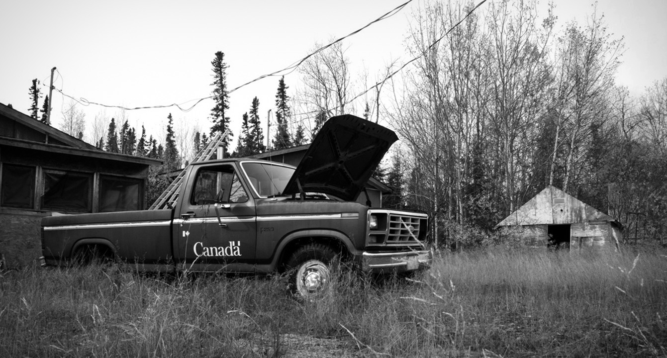
Nearby stands the old abandoned fishworks, where hunters and fishermen park their vehicles for the day…

The cold, clear waters of Windigo Lake…


A few hundred yards from the north shore of the lake is the spot I came all this way to see…the northernmost drivable point in Ontario, Canada. 52° 37′ 58″ N…

Having completed my mission, I enjoyed a relaxing drive back to Pickle Lake, basking in the beautiful October sky and the endless forest; the great silence broken only by the wind, the wheels on the road and Nick Drake on the stereo…


I made it back to the hotel about thirty minutes past sundown; a long but especially satisfying day. This would be my last trip in the Pontiac before the extensive body restoration project, which would keep me off the road for the next three Octobers. Finally, in 2012, I blew this latitude record out of the water. That story, next time.
